Sunday, November 30, 2008

Florida Plates

So what happens when one of your hiking buddies can't go hiking with you? Naturally you steal something that they will miss...or at least miss it when they find out you stole it.

When Moses could not go to Georgia with us I did the next best thing and took something of his with us.


Now wouldn't it be great if I actually took this off of his motorcycle and he went riding around without it, how would you explain that one to the cop?

"Honestly officer, it was here yesterday!"

But alas, he sold his motorcycle a few months back, so I just stole it off of his desk.


At various points along the trail we stopped for a photo opp with the license plate...and people gave us very strange looks. I cannot blame them really, I would give me strange looks too if I could.


We took some photos of the plate at some pretty amazing views and texted them back to Moses.


My favorite was at the GA / NC border where there seemed to be a paradox of sorts...MYFLORIDA.com straddling two states.

Wednesday, November 26, 2008

Springer Mt to Sassafrass Mt: Mile 0 - 11

Our hike began rather ominously when, on the drive down, my wife discovered that I had left my camera sitting on the kitchen counter. A quick trip to Walmart solved that issue (no, not my forgetfulness...the camera).

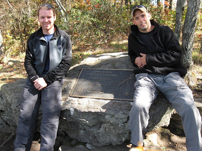
Then...after hiking Springer Mountain Straight Leg realized that his Oakley sunglasses were missing. You can clearly see them on top of his hat in this picture, unfortunately there was no Walmart on the mountain.

Fortunately that
was the extent of our missing items...unless we lost something that we don't miss, but then I guess we don't need it.

Springer Mountain was beautiful and we were
excitedly looking forward to the rest of our hike. We left the parking lot at about 1:30 pm after hiking Springer Mountain with Pop.

The fist day was very uneventful, we felt good and we hiked fast. The trail was very flat and easy until Sassafrass Mountain. Up at the top of Sassafrass Mountain we set up camp along with another hiker, made dinner, and went to bed. And then...the WIND...


Tuesday, November 25, 2008

The Gear

For any gearheads out there here is a partial list of what I carried while hiking the Georgia AT, what is that you say...gear is not interesting...i beg to differ. Gear is very interesting and it has changed so vastly since the early days of hiking, and even more since the early days of Indians...

Just check out this 1950's era backpack, how would you like to wear that? Kind of looks like a toilet! However, some gear can be overrated, and becomes more about fashion than function...if you don't believe me just look at Grandma Gatewood who hiked the AT in Keds sneakers with a canvas duffel bag for a pack and a shower curtain for a shelter...at the age of 67.

But I digress, here is my partial gear list:

Pack - GoLite Odyssey with a 100 oz Camelback Internal Bladder

Bag - Marmot Never Winter 30F / -1C

Cook Stove - MSR Pocket Rocket

Cook Ware - GSI Soloist Cook System (made for 1 person cooking but plenty big enough for 2)

Other Misc. Gear and Clothing

My pack, gear, food for 3 days and water weighs in at approximately 26 - 27 lbs.

We carry a tent with us (GoLite), Straight Leg carries the tent and I carry the dinners.

This was my first hike with the GoLite pack and it was wonderful. I have always had a problem with my other pack after about two days it starts to bruise my hips and my shoulders. After five and a half days with the Golite it still felt great!

Friday, November 21, 2008

Blood Mountain

"Blood Mountain—According to tales of the Creek and Cherokee, a battle between the two nations on the slopes of the mountain left so many dead and wounded that the ground ran red with blood, which inspired the name." - Appalachian Trail Thru-Hikers’ Companion–2007

Thursday, November 20, 2008

The Path


Words so often get in the way of what is important, or beautiful, or amazing... kind of like mine are doing right now.

This photo was taken on the AT in North Georgia where the trail follows an old logging road, Straight Leg and I stopped here to eat lunch and enjoy the warm sunlight.

Wednesday, November 19, 2008

What's in a Name?

Ok, so queen grasshopper has been bugging me to reveal the origin of my trail name, Croc. So here it is...

Croc

I will save the explanation of the best name for last, but for now...about 50 miles into our hike I felt like I was developing a blister on my left heal, so I tried various ways to limit the discomfort. As it turned out it was not a blister but my achilles tendon becoming irritated. Over the next few miles the discomfort got progressively worse until I felt that I could not wear my hiking boot any longer...so I took it off.


My Croc was the only thing that did not rub the back of my heal, I even tried my sneakers but with little luck so I wore my Croc for about 24 miles. We were sitting around near the end of the hike trying to figure out our trail names, Joe and Pop instantly said "your name is Croc".

Straight Leg

After Day 2 Joe's knee began to bother him and the weather was turning very cold, so we called Pop and had him pick us up early that day. Joe hiked the following two days keeping his left leg completely straight to minimize the movement in his knee. There were times on the trail that this was easy and other times it was very difficult; like when the left side of the trail was higher than the right side, or when we were climbing up (or down) a mountain. This continued for almost 28 miles until his knee finally started to feel better.


Moses

Dan did not hike this portion of the AT with us but has hiked with us on another section of the AT in Virginia called Three Ridges. Dan was new to hiking but fell in love with the solitude and beauty and prior to the trip picked up a great walking staff.


And thus the biblical name of Moses, for the record we did not have problems crossing any bodies of water nor issues with pestilence.

Bike / Strap


I struggled with how to explain this name, I decided to forego the picture and simply give the following background information. My father (Pop) was kind enough to commit to supporting us in our quest of hiking the AT. He drove down with us, met us at road crossings for re-supply, brought us Dr. Pepper (yes I am addicted), and drove all around North Georgia. Pop probably knows more about North Georgia roads than he cares to. He put us up for a warm night in a cabin, met us for short hikes on the trail, transported hikers into town, and made friends with hotel owners. Bike was our invaluable "support" during our hike. His name was his own suggestion, and it was brilliant!

For those who need just a little more explanation, Bike is a brand of athletic supporter (commonly known as a jockstrap).

Tuesday, November 18, 2008

The "Ironman Hiker" and Poor Planning

Before starting our trek Straight Leg and I felt we had done a good job planning, we knew there were things that we had not thought of but for the most part we felt that we had things covered. We were carrying enough--but not too much--food, we had our gear portioned out between the two of us, and we knew where we were going (in other words we knew to follow the white blazes and we had our maps--not rocket science). These seemed like pretty standard planning items to us until we met the "Ironman Hiker".

In the parking lot at Springer Mountain we met a guy getting ready to start off on a stage hike of his own. His plan: to hike to the Georgia - North Carolina border and back in 7 days. I am sure he did not notice my jaw hit the ground--not because I felt it could not be done, not because it was approximately 150 miles round trip, and not because (for those of you who are simple math challenged like me) that would mean hiking almost 21.5 miles per day (keep in mind it is already noon on day 1).

Nope, I had my doubts for two main reasons...the first was that he was carrying a military style ruck sack that must have weighed in at more than 70 lbs (it must have felt like carrying a small elephant on his back). He commented that he did not know what to bring...so he brought everything!

What?!? Really, everything!?!

The second reason was that his opening question to us was "hey, do you know which way I am supposed to head on the Appalachian Trail?"
Ok, a little explanation:
The Springer Mountain parking lot is located on Forest Service Road 42 about 0.9 miles North of the Springer Mountain summit and the Southern Terminus of the Appalachian Trail. So to begin the hike you must hike South on the AT 0.9 miles to the Springer Mountian summit, then turn around and begin hiking North. The trail instructions/ directions at the parking lot are clearly marked.

If you want to hike to the North (he was planning on skipping Springer Mountain) and there is a white blazed trail heading North and a white blazed trail heading South...it seemed pretty clear to us which one to take.

We did not see the "Ironman Hiker" for the rest of the trip, we did however talk to someone who had seen him on day 3 at the Gooch Mountain Shelter (mile 15), heading South back to Springer Mountain...

He must have made better time than he thought...

Sunday, November 16, 2008

Georgia Thru Hike - Planning

We started planning about 3-4 months prior to our hike. The maps below show the elevation view of the trail through the State of Georgia and the portion of North Carolina that we completed.

The Original Plan

The original plan was to leave on Saturday morning and arrive at the Springer Mountain parking lot late in the afternoon. That night we would camp near the parking lot and start early the next morning.

Reality

Life has a way of changing your best laid plans, 0ur original plan was delayed half a day due to a bad back, and thus a late start. Fortunately this was only a delay not a cancellation. We arrived at the Springer Mountain parking lot on Sunday about noon. This put us about a half day behind.

The Original Plan

We had planned to hike about 14 to 15 miles per day with a couple 11 to 12 mile days thrown in for "easy" days.

Reality

We felt we were behind and wanted to make up ground, so we hiked almost 11 miles the first half day and more than 16 miles the second day. All of a sudden we found ourselves back on our original schedule, or so we thought (insert ominous foreshadowing here).

The Original Plan

We started off the last week in October and had planned for weather in the 60's during the day and the high 30's at night based upon historic high's and low's.

Reality

The weather started off very nice (60's during the day and low 40's at night) and was very nice by the end of the trip (about the same). There was not a drop of rain the entire trip, so we were grateful for the clear skies. However, the first night we were out the wind picked up and blew hard (and I mean hard) for the next three days. The temperature dropped and we recorded temperatures as low as 27F, this made getting up in the morning a real chore. I don't typically mind cold weather but because we were planning on high 30's/low 40's at night, I brought my 30F sleeping bag...it worked out fine, I just wore ALL of my clothes to bed.

Thursday, November 13, 2008

The Beginning


Here is the question; how do you hike the Appalachian Trail, all 2,175 miles from Springer Mountain, Georgia to Mount Katahdin, Maine across 14 States reaching a maximum elevation of 6,625 feet without taking 5 to 6 months off of work?

Our answer is to hike sections of the AT each year until the entire trail is complete, called "stage" hiking. My hope is to chronicle the adventures with this blog, mile by mile and trip by trip. The characters are Joe aka "Straight Leg", our support and resupply Pop aka "Bike" aka "Strap", anybody else that joins us on our journeys, and myself Chris aka "Croc".